LAND AND BUILDING MAPPING
Land surveying involves the measuring and marking of land to define property boundaries and other site features.
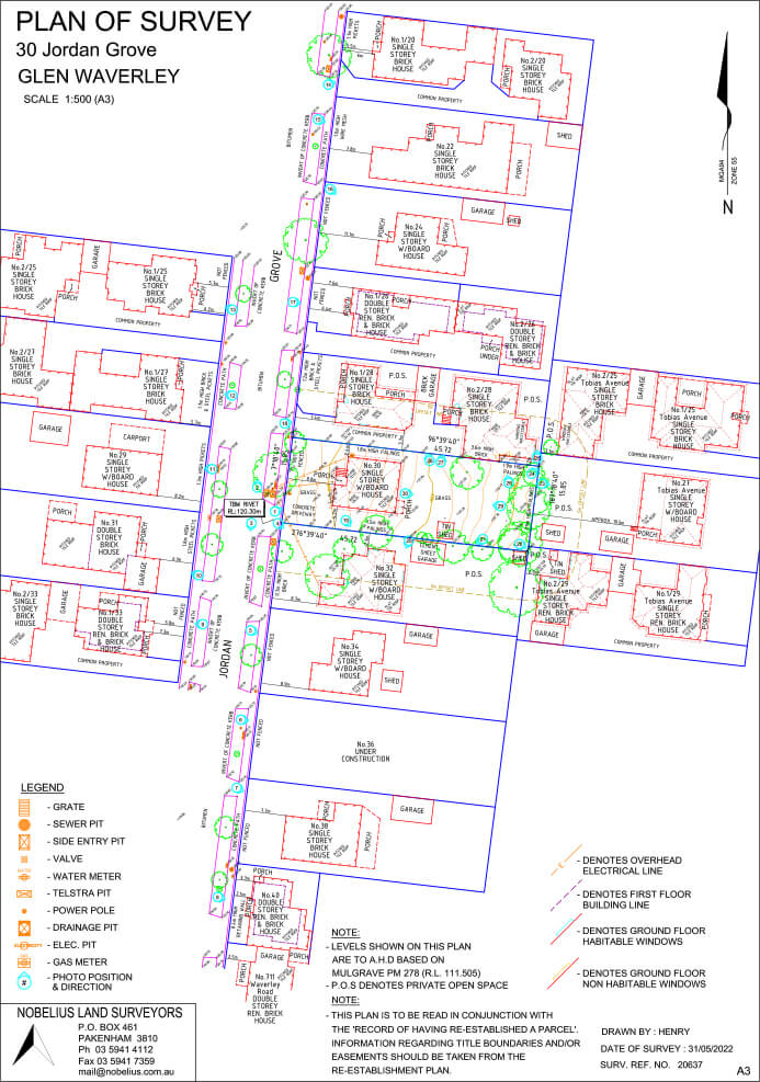
EXISTING CONDITIONS SURVEYS
If you’re looking to build or extend on your residential property, or subdivide or develop your land, you’ll first need a clear and accurate picture of the Title Boundaries and existing site features and levels. Engaging a Licensed Surveyor from the start is a must for any construction project as it provides your designer with the information they need to create a design that maximises the potential of your land.
Our team of Surveyors have extensive experience mapping the land and site conditions on single house builds right up to large scale Greenfield development. We utilise specialised instruments and equipment to map out your site and create a 3D model that includes topographical data, Easements, existing Title Boundaries and other relevant information specific to your project. We’ll provide all the necessary data and reports to enable Title Boundaries, building sites and other specified features to be clearly and legally defined.
plan
Boundary Confirmation
Whether you’re a seasoned developer or are subdividing for the first time, we’ll provide the right level of service at every step of your project to ensure the whole process runs smoothly from start to finish. Here’s an overview of what you can expect:
Step 1:
After an initial conversation where we find out the specifics of your project and requirements, our Surveyors will visit your site to map the existing conditions. This will include features and structures such as buildings, trees, driveways, fences, services and topographical data including ground slope. We’ll also identify Title Boundaries and Easements.
Step 2:
Using the data collected from the site survey, we’ll create a 3D model and plan that includes all the site features, structures and Title Boundaries of your land.
We will also prepare a Title Re-Establishment plan showing the Boundaries, Easements, the relationship between the site Boundaries and fencing, and any marks left onsite. This plan is signed by a Licensed Surveyor and can be used as a legal document in the event of a dispute.
Step 3:
Your designer will use the plan and 3D model to gain a thorough understanding of the opportunities and constraints of your site. They can then create a design that is the right fit for your land and needs.
Step 4:
Once the design is finalised and the plans have been approved, our Surveyors will return to site to show your builder exactly where the proposed works are to be located.
If you’d like to find out how we can help you with building envelopes, land boundaries and setting out of the placement of house slabs on your building project, contact our team on 1300 NOBELIUS
TESTIMONIAL
“I deal with Nobelius Land Surveyors regularly and find them prompt and professional whenever engaged.
Ben the Managing Director who I’m sure is extremely busy always finds time to take or return my calls in a timely manner and it’s not just Ben the whole team is great to deal with and that’s why we keep coming back. For large or small surveying requirements you can’t go wrong with this company.”
Brad Creighton at Landgipps
Contact Us
Phone: 03 5941 4112
20 Henry Street,
Pakenham, Victoria 3810
PO Box 461,
Pakenham Victoria 3810
E: [email protected]